Newport Beach gives two transportation answers, not one. A few harbor-side pockets let you cover daily life on foot, by bike, or via ferry. The rest of the city requires a car.
How you commute is settled the moment you pick your address. If you want to leave the car in the garage, you have to target specific streets, and those streets come with their own trade-offs in parking and peak-season traffic.
Key takeaway
To drive less in Newport Beach, start on Balboa Island or the Balboa Peninsula. The ferry, the seasonal trolley, and the oceanfront path handle many daily trips in those neighborhoods. If fast freeway and airport access matters more, Eastbluff and Newport Coast trade walkability for quicker outbound routes. A condo is the cheaper way into either setup, running a median $1,115 per square foot against $1,779 for a single-family home during the 90 days ending September 30, 2026.
Who this guide is for
You're comparing parts of Newport Beach and want to know how daily errands, the airport run, and summer traffic change depending on where you buy.
Do you need a car in Newport Beach?
Most of the city is car-dependent. The harbor splits the area, Coast Highway acts as the main spine, and the inland neighborhoods sit on hills and wide arterials. Whether you need a car depends on your exact address, because a few harbor-side pockets let you drive far less.
The condo side of that choice is the softer market right now. The median condo price fell 0.9% year over year, while single-family homes saw a 6.6% rise during the 90 days ending September 30, 2026. If a condo fits your plans, that flat pricing gives you room to negotiate.
Neighborhoods where you can drive less
These are the car-optional pockets of the city. Living here means you can handle groceries, coffee runs, and harbor access without turning a key.
You pay for that convenience in other ways. When summer arrives, these areas absorb the bulk of the city's visitors, which brings tight parking and heavy weekend traffic right to your door.
Balboa Island
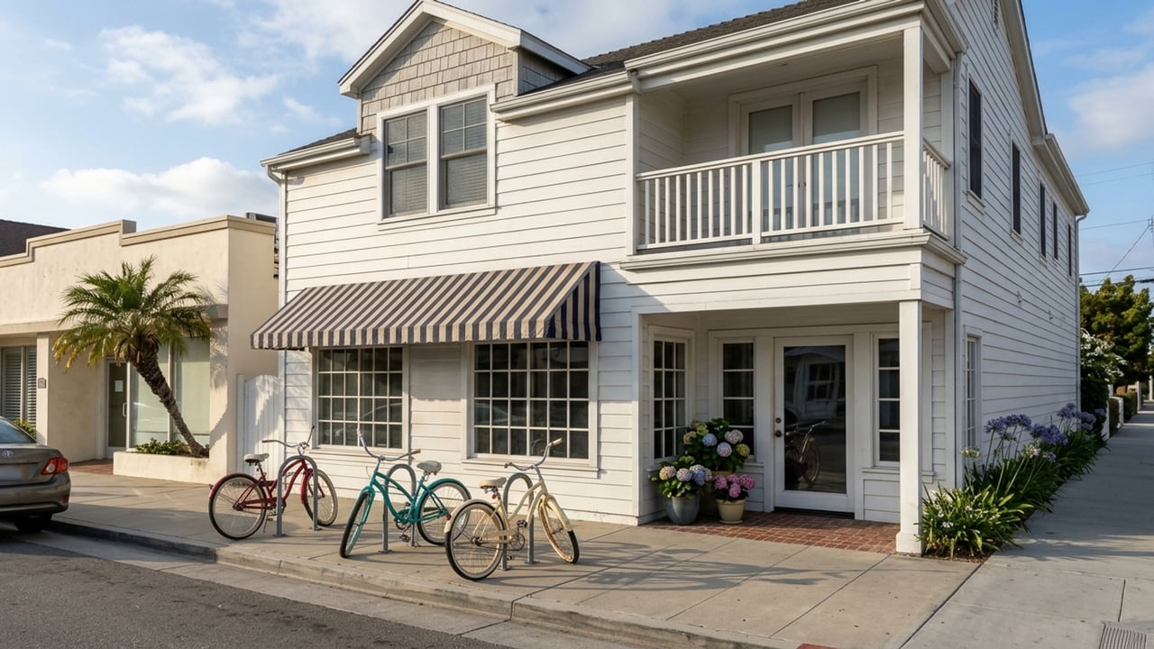
The Balboa Island Ferry has carried cars, bikes, and walkers across the harbor to the peninsula since 1919. Current fares are $2 for adult pedestrians, and the boat runs continuously from 6:30 a.m. to midnight every day. With the ferry on one side and Marine Avenue on the other, most daily errands are walkable or bikeable.
The downside is that summer visitors fill the avenue and the bridge. Lots are tight with alley garages, and street parking is scarce. Measure the garage and confirm alley access on island lots before making an offer.
Balboa Peninsula
The peninsula offers a long, flat strip where a beach cruiser covers the piers, Lido Marina Village, and the Fun Zone. The city runs the free Balboa Peninsula Trolley in peak season to manage congestion. For 2026, it operates Saturdays, Sundays, and summer holidays from May 23 through September 7.
Lido Isle sits just off the peninsula, bridge-connected and quieter, if you want to stay near the water without the full peninsula crowds. The catch to peninsula living is that Balboa Boulevard is essentially the only road in and out. The trolley doesn't run year-round, so off-season you're back on the bike or in the car, and summer weekends back up badly. Confirm the trolley's current-season dates on the city site.
Neighborhoods that mix walking and driving
These areas offer a middle ground for buyers who want some walkability without the intense peninsula crowds. You get a walkable core or a short hop to one, but most errands still require a car.
You'll still deal with seasonal traffic, especially along the main coastal routes. What you gain is easier access to the rest of Orange County while keeping a village feel nearby.
Corona del Mar
The village strip runs right along Coast Highway, putting shops and restaurants within walking distance from the flower streets. An OCTA bus line runs through the village on the same road, which is a useful combination if you'd rather not drive every trip.
Walking to the village means living near Coast Highway through-traffic and crossing it regularly. Beach-day parking also spills onto residential streets. Ask the City of Newport Beach whether your block requires a residential parking permit and what guests can do.
Newport Heights
Newport Heights sits on the bluff between the harbor and Costa Mesa, close to Newport Boulevard. The 55 freeway ends near Newport Heights at Newport Boulevard, which makes the inland run unusually direct for a harbor-adjacent area.
That location keeps inland trips short and keeps you away from the deepest peninsula traffic. The downside is that the Newport Boulevard and Coast Highway junction is a regular choke point. Most daily errands here are still a short drive rather than a walk.
Neighborhoods built around the car
In these areas, nearly every trip is a drive. Street layouts cater to vehicles, with wide roads, gated entries, and significant elevation changes.
What you get in exchange is fast freeway, toll road, and airport access, plus quieter streets far from the harbor's congestion.
Eastbluff
Eastbluff sits on the city's inland edge near John Wayne Airport and Jamboree Road, which makes it the shortest hop to the airport and inland job centers. The 10.5-mile Back Bay Loop trail circles Upper Newport Bay right next door, offering paved paths for biking and walking.
That trail is for recreation. Daily errands all require a car. Being close to the airport also means being close to departures, so look up the address against John Wayne Airport departure procedures and visit at a busy departure hour before you commit.
Newport Coast
Newport Coast relies on the 73 toll road and gated hillside streets for fast access south and inland. The fastest route out uses the 73, which charges variable rates based on the time of day. For 2026, a two-axle vehicle pays around $4.13 to $4.67 depending on peak hours.
Steep roads make biking for errands impractical, and regular toll use adds a running cost. Ask the HOA about gate entry for guests and deliveries, and estimate your monthly toll cost if you'll use the 73 regularly. You can read more about how these communities operate in our guide to local homeowner associations.
Public transit, airports and freeways in Newport Beach
OCTA buses serve the main corridors throughout the city, but transit fills gaps rather than replacing a car outside the walkable pockets. There's no Metrolink station in the city limits. The nearest option is Tustin Station, which you reach via a combination of Metrolink trains and connecting OCTA bus lines.
Rideshare remains the default for airport runs and nights out. The 405, 73, 55, and Coast Highway frame the city, while John Wayne Airport sits right on the inland edge. You can compare a cash offer and broader cost-of-living trade-offs to see how these transportation costs fit your budget.
Newport Beach housing market by home type
The local housing market splits sharply by property type. Condos currently offer more supply, with 4.5 months of inventory compared to 3.8 months for single-family homes, and they sit a little longer too, taking a median 70 days to sell versus 65 days for detached houses.
That gives condo buyers more time and choice, though you shouldn't expect deep discounts. Condos still close at 97.6% of their list price, while single-family homes close at 96.7%. The overall market saw a 13.2% price rise over the last year, but that reflects pricier sales in the mix rather than pure appreciation.
Always verify these figures against current listings, as this is not financial advice. You can check your property tax bill estimates and review our buying guide for more details. If you want a smaller home in a drive-less setup without paying single-family prices, focus on condo listings.
How to choose a neighborhood by how you get around
Your transportation needs should dictate your home search. Drive your commute from the address at rush hour, and again on a peak-season weekend, before committing. Reviewing the pros and cons of living in Newport Beach can help organize these priorities.
Use these four questions to narrow your options:
- Do you want to handle most daily errands without the car? If yes, start with the car-optional areas and skip the car-built neighborhoods.
- How often do you fly or drive inland to Irvine, the 405, or the 73? If it's weekly or more, read about the car-built areas and freeways first.
- Can you live with peak-season crowds and traffic at your door? If not, the island and peninsula are a hard fit, so look at the mixed areas.
- Would a condo work for you? If yes, that segment gives you more time and choice.
If you're weighing factors beyond transportation, review our guide to choosing a neighborhood.
At a glance
- Median sale price, all homes: $3,848,167, up 13.2% year over year (90 days ending 2026-09-30, 284 sales)
- Median sale price, single family: $4,810,582, up 6.6% year over year (90 days ending 2026-09-30, 200 sales)
- Median sale price, condo: $1,894,805, down 0.9% year over year (90 days ending 2026-09-30, 58 sales)
- Median price per square foot: $1,779 single family, $1,115 condo (90 days ending 2026-09-30)
- Median days on market: 65 single family, 70 condo (90 days ending 2026-09-30)
- Sale-to-list ratio: 96.7% single family, 97.6% condo (90 days ending 2026-09-30)
- Share sold above list: 9.1% single family, 8.8% condo (90 days ending 2026-09-30)
- Months of supply: 3.8 single family, 4.5 condo (90 days ending 2026-09-30)
- Homes for sale: 391 all homes, 251 single family, 85 condo (90 days ending 2026-09-30)
Getting around Newport Beach FAQs
Is Newport Beach, CA walkable?
It depends on the specific address. The city has an overall Walk Score of 49, a Transit Score of 27, and a Bike Score of 53. The most walkable neighborhoods are West Newport Beach, Newport Heights, and Balboa Island, so look up the score for the exact address you're considering.
What airport is closest to Newport Beach, CA?
John Wayne Airport (SNA) is the closest option, located right on the city's inland edge. Los Angeles International Airport (LAX) serves as the long-haul alternative. Newport Beach to LAX is about 44 miles, which typically takes 49 to 55 minutes without traffic, but 75 to 100 minutes during peak rush hours.
How far is Newport Beach from Los Angeles?
Newport Beach is about 40 miles from downtown Los Angeles. The typical drive time is roughly 50 to 55 minutes in normal traffic, and that increases during rush hour.
How much does the bus cost in Newport Beach?
For 2026, the OCTA single fare is $2.00 for a one-way ride. There's a daily fare cap of $4.50 and a monthly fare cap of $69.00 under the Wave fare system. Several OCTA routes serve the city, including routes 47, 57, 71, 79, and 55.
Is there free parking in Newport Beach?
Free street parking exists in select residential areas, but most high-demand lots require payment. Ask the city about permit zones on your specific block to see if free parking is an option near your home. Check the city's current meter rates and beach lot fees for public spaces.
How long is the Newport Beach boardwalk?
The Oceanfront Boardwalk stretches nearly three miles, running from E Street to 36th Street along the Balboa Peninsula. The paved path is popular with walkers, runners, and cyclists.
How long does it take to drive from Newport Beach to Laguna Beach?
The drive takes about 17 to 20 minutes without traffic. The distance is approximately 10 to 11 miles via Pacific Coast Highway (CA-1). You can also use the 73 toll road for a faster inland option during coastal traffic jams.
When is traffic worst in Newport Beach?
Traffic peaks during summer weekends and major holidays like Memorial Day, the Fourth of July, and Labor Day. The Balboa Peninsula backs up severely on these dates as visitors fill the parking lots. The city runs a free trolley on these peak days specifically to manage the congestion.
Sources
- Redfin: Data Center
- Balboa Island: Everything You Need to Know About the Balboa Island Ferry
- City of Newport Beach: Balboa Peninsula Trolley
- OCTA: Complete Bus Book
- City of Newport Beach: MetaViewer
- Rome2Rio: Newport Beach to Los Angeles Downtown
- Rome2Rio: Newport Beach to Laguna Beach
- The Toll Roads: Map & Rates
- Newport Dunes: Newport Beach Bike Trail
- Metrolink: Newport Beach
- CEQAnet: SR-55 Attachment